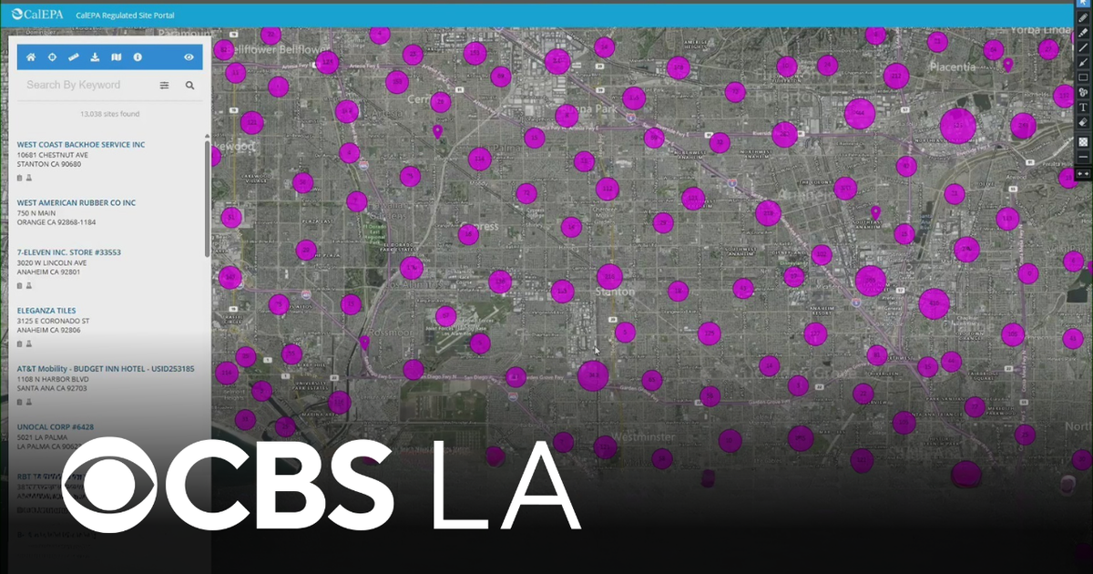
CalEPA Releases Interactive Map of Regulated Businesses
Residents of Cerritos and the surrounding areas can now easily determine if they live near businesses regulated by the California Environmental Protection Agency (CalEPA). An interactive map has been made available, showcasing all locations that fall under CalEPA's jurisdiction, allowing community members to stay informed about potential environmental impacts in their neighborhoods.
The map, which was reported by CBS News, is part of CalEPA's ongoing efforts to enhance transparency and public awareness regarding environmental regulations. By providing this resource, CalEPA aims to empower residents with information about the businesses operating in their vicinity that are subject to environmental oversight. This initiative is particularly relevant for those concerned about air and water quality, hazardous waste, and other environmental factors.
Understanding the Map's Features
The interactive map allows users to zoom in on specific areas and click on individual markers to obtain detailed information about each business, including the type of operations conducted and any relevant environmental compliance records. This feature is designed to facilitate community engagement and ensure that residents are aware of the environmental responsibilities of local businesses.